
Fichier:Egypt Al Wadi al Jadid locator map.svg

Taille de cet aperçu PNG pour ce fichier SVG : 662 × 600 pixels. Autres résolutions : 265 × 240 pixels | 530 × 480 pixels | 848 × 768 pixels | 1 130 × 1 024 pixels | 2 260 × 2 048 pixels | 1 055 × 956 pixels.
Fichier d’origine (Fichier SVG, nominalement de 1 055 × 956 pixels, taille : 351 kio)
Ce fichier et sa description proviennent de Wikimedia Commons.
Description
| Description |
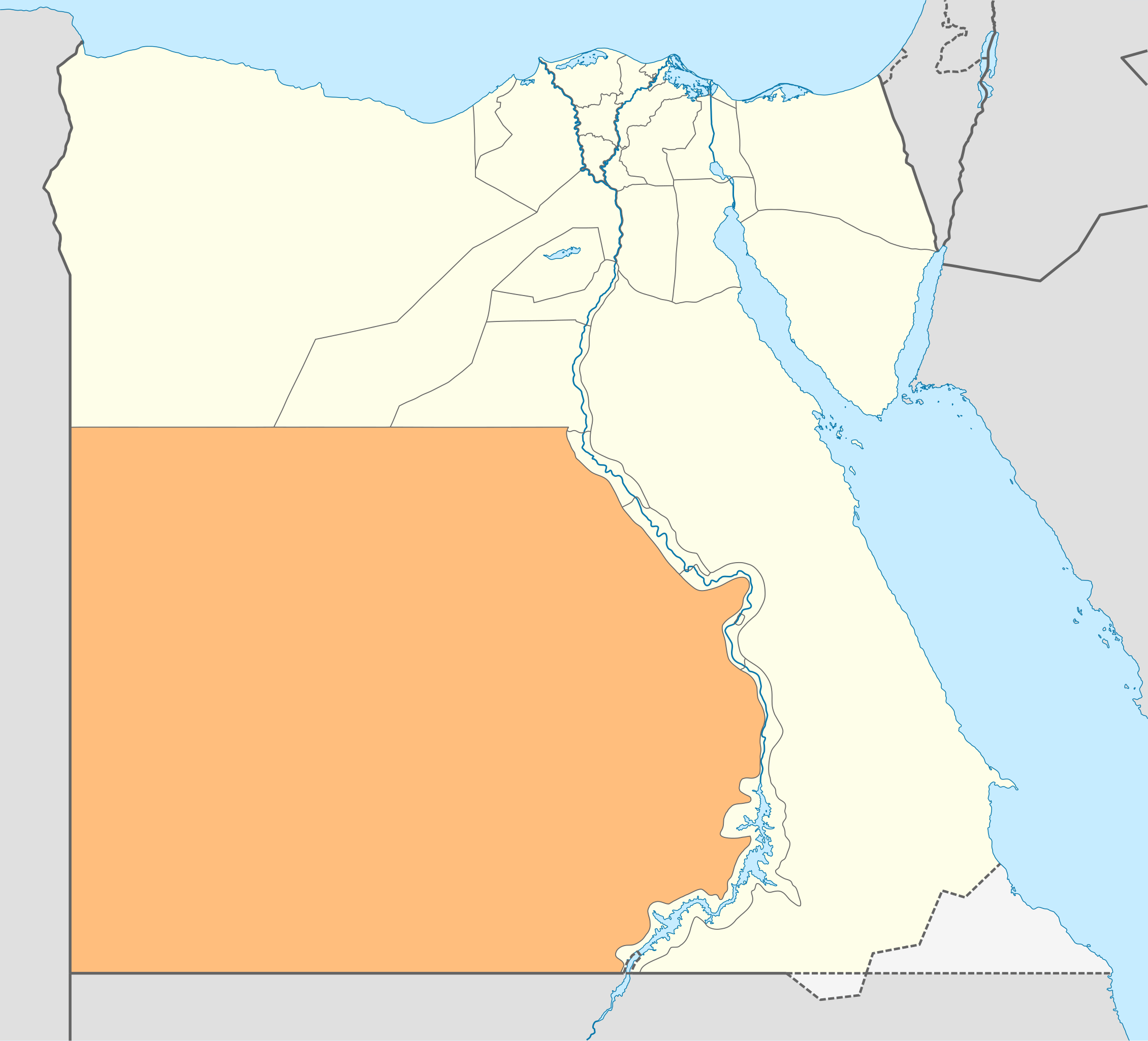
Deutsch: Lagekarte des Gouvernements New Valley—Al-Wadi al-dschadid in Ägypten
English: Locator Map of the New Valley Governorate of Egypt — the former Al Wadi al Jadid Governorate’’. |
| Date | |
| Source | Travail personnel |
| Auteur | NordNordWest |
| Autorisation (Réutilisation de ce fichier) |
Moi, en tant que détenteur des droits d’auteur sur cette œuvre, je la publie sous la licence suivante : Ce fichier est disponible selon les termes de la licence Creative Commons Attribution – Partage dans les Mêmes Conditions 3.0 (non transposée).
|

|
Cette carte a été créée ou améliorée dans le Kartenwerkstatt (Atelier cartographique allemand). Vous pouvez également y proposer des cartes à améliorer.
|
Historique du fichier
Cliquer sur une date et heure pour voir le fichier tel qu'il était à ce moment-là.
| Date et heure | Vignette | Dimensions | Utilisateur | Commentaire | |
|---|---|---|---|---|---|
| actuel | 17 avril 2011 à 18:21 | | 1 055 × 956 (351 kio) | NordNordWest | upd |
| 3 septembre 2009 à 13:55 |  | 1 055 × 956 (560 kio) | NordNordWest | {{int:filedesc}} {{Information |Description= {{de|Lagekarte des Gouvernements Al-Wadi al-dschadid in Ägypten}} {{en|Locator map of the Al Wadi al Jadid Governorate in Egypt}} |Source={{Own}} |Date=2009-09-03 |Author={{U|NordNordWest}} |Permission={{self |
Utilisation du fichier
La page suivante utilise ce fichier :
Usage global du fichier
Les autres wikis suivants utilisent ce fichier :
- Utilisation sur bg.wikipedia.org
- Utilisation sur de.wikipedia.org
- Utilisation sur de.wikivoyage.org
- Bārīs
- ʿAin Muṣṭafā Kāschif
- ʿAin Schams ed-Dīn
- ʿAin Umm ed-Dabādīb
- Chārga
- Chārga (Stadt)
- Farāfra
- Farāfra (Stadt)
- Gabbānat el-Bagawāt
- Gāra (Neues Tal)
- Gebel eṭ-Ṭeir (el-Chārga)
- Qaṣr el-Ghuweiṭa
- Hībis
- Ismant
- Kristallberg (Libysche Wüste)
- Deir el-Munīra
- Nāḍūra
- Qaṣr Dūsch
- Qaṣr el-Labacha
- Qaṣr ez-Zaiyān
- Hassan Fathy Village (el-Chārga)
- ʿAin Manāwir
- Maks el-Qiblī
- Qilāʿ eḍ-Ḍabba
- Nationalpark Weiße Wüste
- ʿAin el-Wādī
- ʿAin Scheich Marzūq
- Abū Minqār
- ʿAin Bisāi
- ʿAin Gallaw
- Biʾr Dikkār
- ʿAin ed-Dālla
- Wādī el-Ubeiyiḍ
- Deir Abū Mattā
- Baschandī
- Qārat el-Muzawwaqa
- Qaṣr ed-Dāchla
- Deir el-Ḥagar
- Budchulū
- Dāchla
- Ḥalfat el-Biʾr
- Ismant el-Charāb
- Tineida
- ʿAin Aṣīl
- Balāṭ
- ʿAin Birbīya
- Qaṣaba
- Qalamūn (ed-Dāchla)
Voir davantage sur l’utilisation globale de ce fichier.