
Fichier:Map of Boston and Cambridge.png

Taille de cet aperçu : 800 × 600 pixels. Autres résolutions : 320 × 240 pixels | 640 × 480 pixels | 1 024 × 768 pixels | 1 280 × 960 pixels | 1 600 × 1 200 pixels.
Fichier d’origine (1 600 × 1 200 pixels, taille du fichier : 1,98 Mio, type MIME : image/png)
Ce fichier et sa description proviennent de Wikimedia Commons.
Description
| Description |
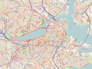
English: Map of the central area of Boston and Cambridge, exported from OpenStreetMap.
日本語: ボストン中心部及びケンブリッジの地図。オープン・ストリート・マップから作成。 |
||||||||||||
| Date | |||||||||||||
| Source | http://openstreetmap.org/ | ||||||||||||
| Auteur | OpenStreetMap contributors | ||||||||||||
| Autorisation (Réutilisation de ce fichier) |
|

|
Cette image (de type complex carte) devrait être recréée dans un format vectoriel, en tant que fichier SVG. Cela offrirait plusieurs avantages : voir Commons:Media for cleanup pour plus d'informations. Si une version SVG de cette image est déjà disponible, merci de bien vouloir l'envoyer. Après cela, remplacez ce modèle par {{vector version available|nouveau nom d'image.svg}}.
|
Maps of Cambridge
Conditions d’utilisation
Ce fichier est disponible selon les termes de la licence Creative Commons Attribution – Partage dans les Mêmes Conditions 2.0 Générique
- Vous êtes libre :
- de partager – de copier, distribuer et transmettre cette œuvre
- d’adapter – de modifier cette œuvre
- Sous les conditions suivantes :
- paternité – Vous devez donner les informations appropriées concernant l'auteur, fournir un lien vers la licence et indiquer si des modifications ont été faites. Vous pouvez faire cela par tout moyen raisonnable, mais en aucune façon suggérant que l’auteur vous soutient ou approuve l’utilisation que vous en faites.
- partage à l’identique – Si vous modifiez, transformez, ou vous basez sur cette œuvre, vous devez distribuer votre contribution sous la même licence ou une licence compatible avec celle de l’original.
Historique du fichier
Cliquer sur une date et heure pour voir le fichier tel qu'il était à ce moment-là.
| Date et heure | Vignette | Dimensions | Utilisateur | Commentaire | |
|---|---|---|---|---|---|
| actuel | 19 juin 2009 à 02:01 | | 1 600 × 1 200 (1,98 Mio) | Goyaz | {{Information |Description={{en|1=Map of the centeral area of Boston and Cambridge, exported from OpenStreetMap.}} {{ja|1=ボストン中心部及びケンブリッジの地図。[[w:ja:オープン・ストリート・マップ|オープン・スト� |
Utilisation du fichier
Les 57 pages suivantes utilisent ce fichier :
- Allston (Boston)
- Aquarium de Nouvelle-Angleterre
- Arboretum Arnold
- Back Bay
- Bay Village (Boston)
- Beacon Hill (Boston)
- Big Dig
- Boston Common
- Charlestown (Boston)
- Chinatown (Boston)
- Cimetière de King's Chapel
- Conservatoire de musique de la Nouvelle-Angleterre
- Consulat général de France à Boston
- Dorchester (Boston)
- Double attentat du marathon 2013 de Boston
- Downtown Boston
- East Boston
- Emerson College
- Faneuil Hall
- Fenway Kenmore
- Fontaine Brewer
- Granary Burying Ground
- Harvard Stadium
- Huntington Avenue Grounds
- Hyde Park (Boston)
- Jamaica Plain
- Jordan Field
- Julien's Restorator
- King's Chapel
- Massachusetts College of Art and Design
- Massachusetts General Hospital
- Mattapan
- Medieval Academy of America
- Mission Hill (Boston)
- Musée de la Science (Boston)
- Nickerson Field
- North Bennet Street School
- North End (Boston)
- Old South Church
- Pont Charlestown
- Port de Boston
- Prison d’État de Charlestown
- Quincy Market
- Roslindale
- Roxbury (Boston)
- South Boston
- South End (Boston)
- TD Garden
- Union Oyster House
- Union Street (Boston)
- Université Northeastern
- Université Suffolk
- Université de Boston
- West End (Boston)
- Église de la Trinité de Boston
- Modèle:Géolocalisation/Boston
- Module:Carte/données/boston
Usage global du fichier
Les autres wikis suivants utilisent ce fichier :
- Utilisation sur ar.wikipedia.org
- Utilisation sur bg.wikipedia.org
- Utilisation sur ceb.wikipedia.org
- Utilisation sur cs.wikipedia.org
- Utilisation sur en.wikipedia.org
- USS Constitution
- Battle of Bunker Hill
- Cocoanut Grove fire
- Wang Theatre
- Isabella Stewart Gardner Museum
- Ether Dome
- South End, Boston
- John Hancock Tower
- Back Bay, Boston
- TD Garden
- Faneuil Hall
- Beacon Hill, Boston
- Old South Meeting House
- Park Street Church
- Trinity Church (Boston)
- Bunker Hill Monument
- Museum of Fine Arts, Boston
- Quincy Market
- North–South Rail Link
- Old State House (Boston)
- John Joseph Moakley United States Courthouse
- Boston African American National Historic Site
- Tremont Street subway
- Harrison Gray Otis House
- Improv Asylum
- Peabody Museum of Archaeology and Ethnology
- Old City Hall (Boston)
- Landmark Center (Boston)
- Harvard Museum of Natural History
- Abbey Lounge
- Gibson House Museum
- The Club of Odd Volumes
- Boston Emergency Medical Services
- Nathan Appleton Residence
- Charles Street Jail
- Old Corner Bookstore
- Our Lady of Mount Carmel Church (East Boston, Massachusetts)
- Morse Auditorium
- Chester Harding House
- Vilna Shul
- William C. Nell House
- Charles Sumner House
- Copp's Hill Burying Ground
Voir davantage sur l’utilisation globale de ce fichier.